
Mountain Homes Realty
Enter City, Zip or MLS

0 us hwy 66/national trails hwy

Newberry Springs, CA 92365
$550,000

577.6 AC LOT
Land
Image 1
Image 2
Image 3
Image 4
Acreage 577.61
Status Active Under Contract
MLS # HD25265426
County San Bernardino
More Info
Category Land
Status Active Under Contract
Acreage 577.61
MLS # HD25265426
County San Bernardino
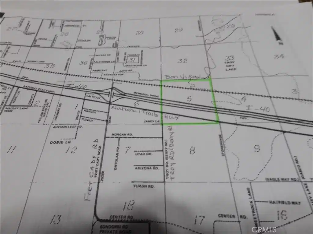
577.61 acres in Newberry Springs. It consists of 4 parcels, stacked on top of each other, that make up an entire Section of land minus the easements for US Hwy 66/National Trails Hwy, I-40, Memorial Drive & the railroad easements. 3 of the 4 parcels are 1 mile long from east to west. The most southerly parcel, APN 0529-151-09, is 27.26 acres. The north line of this parcel has frontage on the south side of US Hwy 66. It begins at Berry Rd (AKA Troy RD) and continues east 1 mile to Stonehenge Rd. The next parcel going north, APN 0529-151-08, is 129.51 acres. It also begins at Berry Rd (AKA Troy RD) and continues east 1 mile to Stonehenge Rd. It's the land between National Trails Hwy and Eastbound I-40. The next parcel going north, APN 0529-151-07, is 46.31 acres. It's the parcel between Westbound I-40 and Memorial Drive and is also 1 mile from east to west. And last but not least, the 4th parcel going north, APN 0529-151-06 is 373.53 acres. It has frontage on the north side of Memorial Drive and goes all the way north past the railroad to Bon View Ave. The NW corner of this parcel is at the SW corner Bonview Ave & Troy Rd. All 4 parcels together total 577.61 acres, allowing plenty of space & so many options. Solar farm, housing development, crops, livestock or all of the above could be achieved. Crops such as Pistachios, Apricots, Avocado, Peppers, Pomegranate & other crops do well in this area. Buyer to verify zoning & availability of electricity. Residents in the area use private wells, septic systems & propane as there are currently no public services for water, sewer or gas. Electric should be available all along US Hwy 66/National Trails Hwy. DIRECTIONS: From Barstow, take I-40 towards Needles. Take the Fort Cady Rd. Exit, get on US Hwy 66, continue east 1 mile to Troy Rd. (AKA Berry Rd). You will be at the approximate NW corner of the of the most southern parcel. Continue another mile east on Us Hwy 66 to the approximate NE corner of the most southern parcel. To view the parcels on the north side of I-40, go back to Fort Cady Rd, turn right right & cross over I-40, turn right on Memorial Drive and go 1 mile. The property will be on your right & on your left.
Location not available
Listing
Street
Satellite

Exterior Features

  • Construction Single Family
  • Garage No
  • Water None
  • Sewer None
  • Lot Description HorseProperty, IrregularLot, Paved, RectangularLot, StreetLevel

Financial Information

  • Parcel ID 0529151090000
  • Zoning RL-5

Additional Services

Internet Service Providers

Listing Information

Listing Provided Courtesy of Trust Real Estate - TrustRealEstate@aol.com
The data for this listing came from the California Regional MLS
Listing data is current as of 07/08/2026.
California DRE #02247371

Contact Our Agent

By clicking “Submit,” I agree to be contacted by Lake Homes Realty, LLC, its affiliates, and real estate professionals via call, text, and email for real estate services. This includes by automated means, even if your number is on a federal, state, or our internal Do Not Call list. To opt out, you can reply "stop" at any time or reply "help" for assistance. You can also click the unsubscribe link in the emails. Message and data rates may apply. Message frequency may vary. You also agree to our Terms of Use and Privacy Policy.